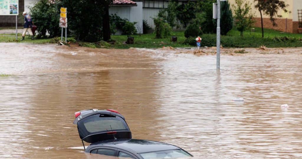
Northern Italy and the Balkans are preparing to face a lot of flooding. The so-called “atmospheric river” is expected to bring heavy rains to the region in the coming days. According to some weather models, hundreds of liters of rain may fall locally. Therefore, frequent flooding is expected. The atmospheric river will provide a lot of snow in the mountains. But what is this weather phenomenon? How much rain is expected exactly? Which areas will receive the greatest burden?
What is an atmospheric river?
Atmospheric rivers are strings (river-shaped) in our atmosphere at an altitude of 1.5 to 2 km that transport masses of water vapor. This often involves volumes of water ten times higher than those in real rivers such as the Rhine, for example. This atmospheric river can be thousands of kilometers long. The driving force behind this atmospheric phenomenon is the jet stream. In Western Europe, atmospheric rivers occur on average once every 10 days, although this does not mean that we should always expect heavy rain.
When this ridge of moisture reaches the shore and encounters a mountain range, the moisture is pushed upward. This causes heavy rains, which may cause large amounts of water and thus floods. This is what will happen in the coming days, southeast of the Alps and northern Balkans.
Read more below the picture
How much precipitation could fall?
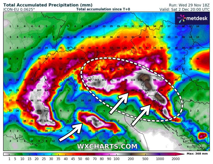
Today and in the coming days, such an atmospheric river will move from southwestern Europe towards the northeast. On its way, it collides with the Southeast Alps and the Dinaric Alps. This causes the moisture to cool, condense, and form clouds with precipitation. Due to the flow of this atmospheric river for hours, heavy rains can fall for a long period in northern Italy and the Balkan region.
Weather models show up to 300mm of rain in northern Croatia and Slovenia and up to 150mm in northeastern Italy until Saturday. Up to 150mm is likely to fall within 24 hours. So this will likely lead to flooding. Most precipitation is accounted for in the Dinaric Alps because the atmospheric river can pick up additional moisture in the Adriatic Sea just before the mountains.
Read more below the picture

The Adriatic Sea is currently 2 – 3°C warmer than normal. Thus an atmospheric river can capture more moisture than average at this time of year. This could contribute to more intense rainfall. Research has shown that the frequency and intensity of atmospheric rivers have increased over the past 70 years. The increase in density can be attributed to rising temperatures, which means that an atmospheric river can contain more water vapor on average.
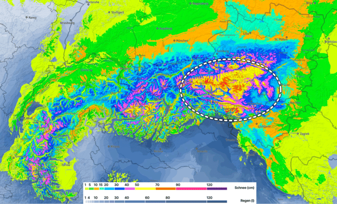
As the air supplied is very temperate, blowing across the Mediterranean, it rains mainly at first. On Saturday, cold air will move south from the north and the snow line will retreat. At high altitudes (above 2000 m), more than a meter of snow may fall until Saturday, especially in southern Austria.
Read more below the picture

Not only are people in Europe bracing for heavy rains, but in the US an atmospheric river on the US West Coast is likely to provide liters of water. The atmospheric rivers in this region are known as the Rapid Pineapple River due to their origin in the Pacific Ocean near Hawaii.
Each year, these atmospheric rivers recur several times and bring an average of three to five days of heavy rain or snow, sometimes resulting in severe flooding. Weather models show that many atmospheric rivers will be concentrated on the West Coast of the United States in the coming days. Rainfall of up to 500 mm is expected in some places, and large amounts of snow may fall on the mountains.
‘Possibly highest snow cover in years at start of winter’: Alps expect up to 1 meter of snow locally this week
The coldest November night in more than 100 years in Copenhagen
Was this fall really cold, gray and wet? This is what the numbers say: “Fall 2023 was above everyone else in one region.”
Free unlimited access to Showbytes? Which can!
Log in or create an account and never miss a thing from the stars.

“Lifelong food practitioner. Zombie geek. Explorer. Reader. Subtly charming gamer. Entrepreneur. Devoted analyst.”


More Stories
The Pope warns that uniformity in the Church is deadly
Finnair cancels flights due to unruly Russians
Hurricane leaves US airport in ruins | the pictures